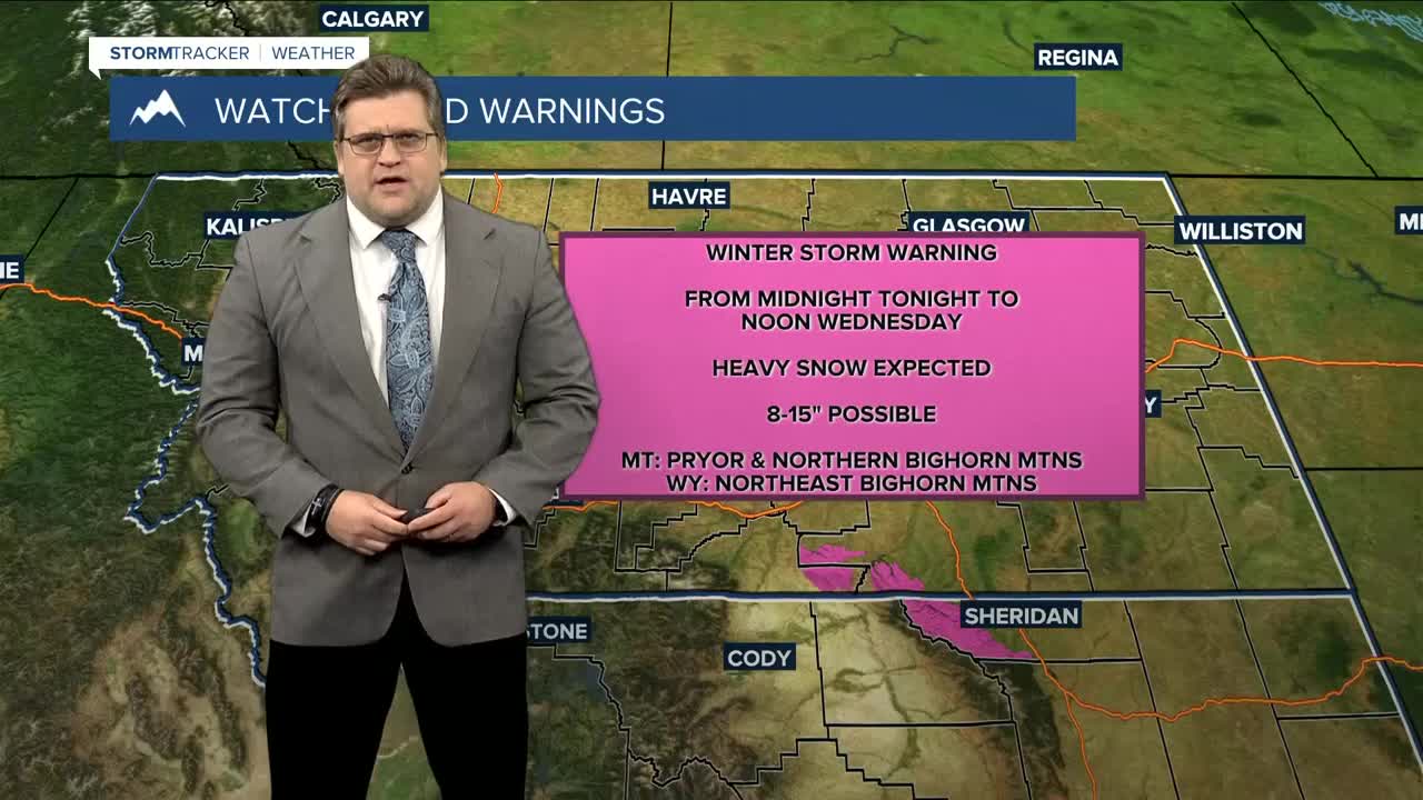


BILLINGS — Cold air and a good bit of moisture will stream in behind a cold front on Monday, bringing lower elevation rain and mountain snow through Wednesday morning. The Absarokas could receive over 6" of snow while portions of the Bighorns could over foot along with gusts up to 35 mph. The Beartooth and Red Lodge Foothills could pick up a couple of inches, too. Winter Storm Warnings and Winter Weather Advisories will be in effect for all of these areas.
Areas along and south of a line from Livingston to Billings to Ekalaka could pick up about a quarter of an inch of rainfall. Portions of northern WY could receive more.
Thursday will be dry as high pressure moves in briefly ahead of another cold front forecast to move through Thursday night, bringing a chance for more rain and mountain snow to our western zones through Friday morning, but accumulations are expected to be light. The weekend aims to be mainly dry with any precipitation isolated to the mountains.
Temperatures will be near seasonal this week. Daytime highs will range from the mid-40s west to around 60° east and south on Monday then mainly 40s and 50s for the rest of the week into the weekend. Nighttime lows will be mainly in the 30s Monday night then mainly 20s and 30s for the rest of the week through the weekend.
-Miller Robson
Q2 Morning Meteorologist
miller.robson@ktvq.com
