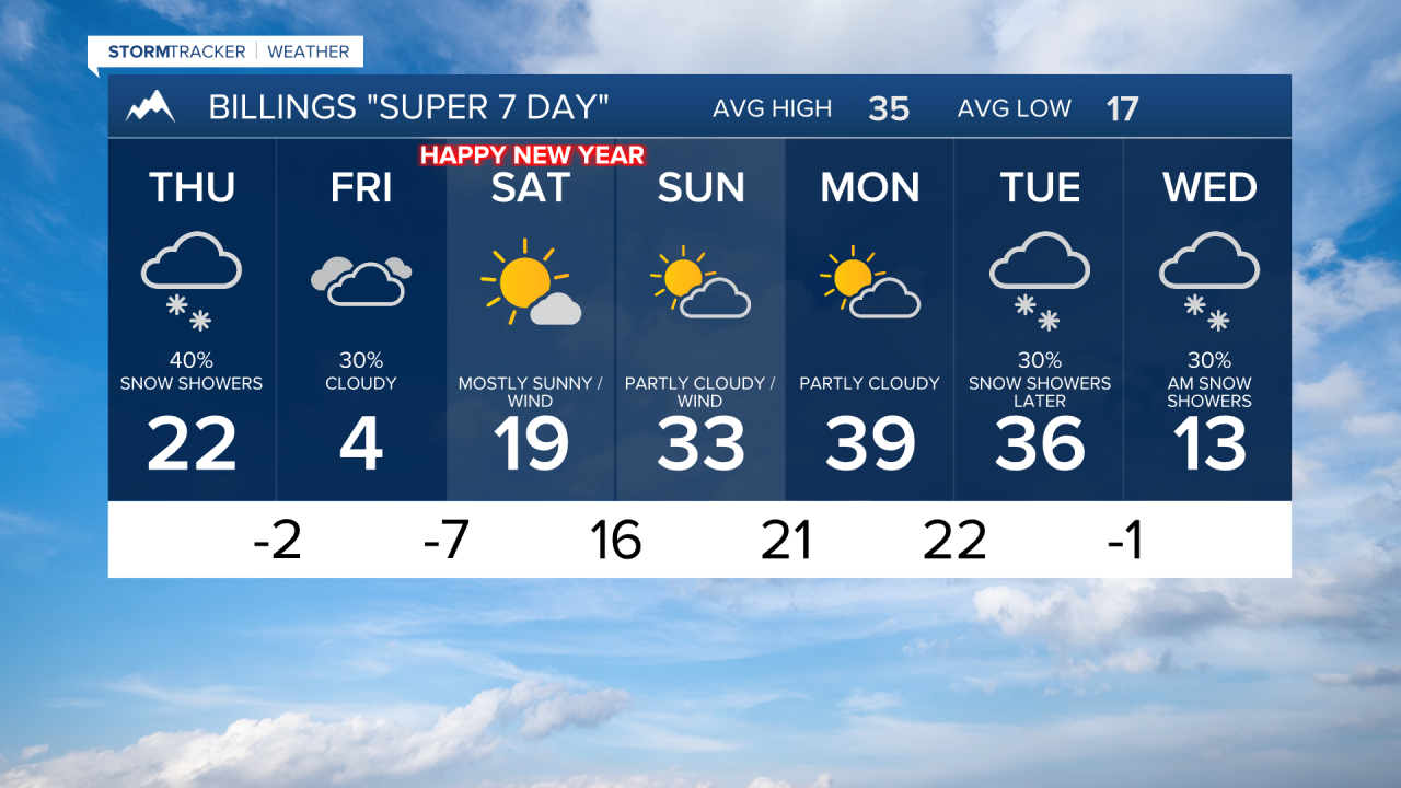


BILLINGS — Areas of light snow and flurries will continue especially west and south of Billings through the evening. Temperatures remain cold, but start to warm even before sunrise.
Wind gusts of 30-45 mph are expected at the usual spots closer to the mountains late Wednesday through Thursday morning. This should be enough for localized blowing snow so be prepared if you will be traveling.
Highs reach the teens to mid 20s on Thursday before the next wave from the northwest brings the next shot of cold air as early as midday Thursday through the afternoon. Periods of mostly light snow develop late t Thursday thru Friday.
Current indications are for 1-2" of snow near Billings, and to the west and south. Some areas could pick up 3 inches or a little more.
Winds as high as 70 mph return in the western foothills Friday night through Sunday evening. A classic Chinook wind pattern setting up overnight Friday and
lasting through Sunday evening.
Temperatures rebound to the 30s Sunday through Tuesday over much of the area. Areas of light snow are possible Tuesday and Wednesday.
