

BILINGS — Scattered showers will continue to affect areas from Billings to the eastern as weak energy moves through. Most of this will be light to moderate rain.
Showers will taper off as ridging from the west begins to take effect. For Tuesday, expect lingering light rain toward the Dakotas with totals generally under a tenth of an inch.
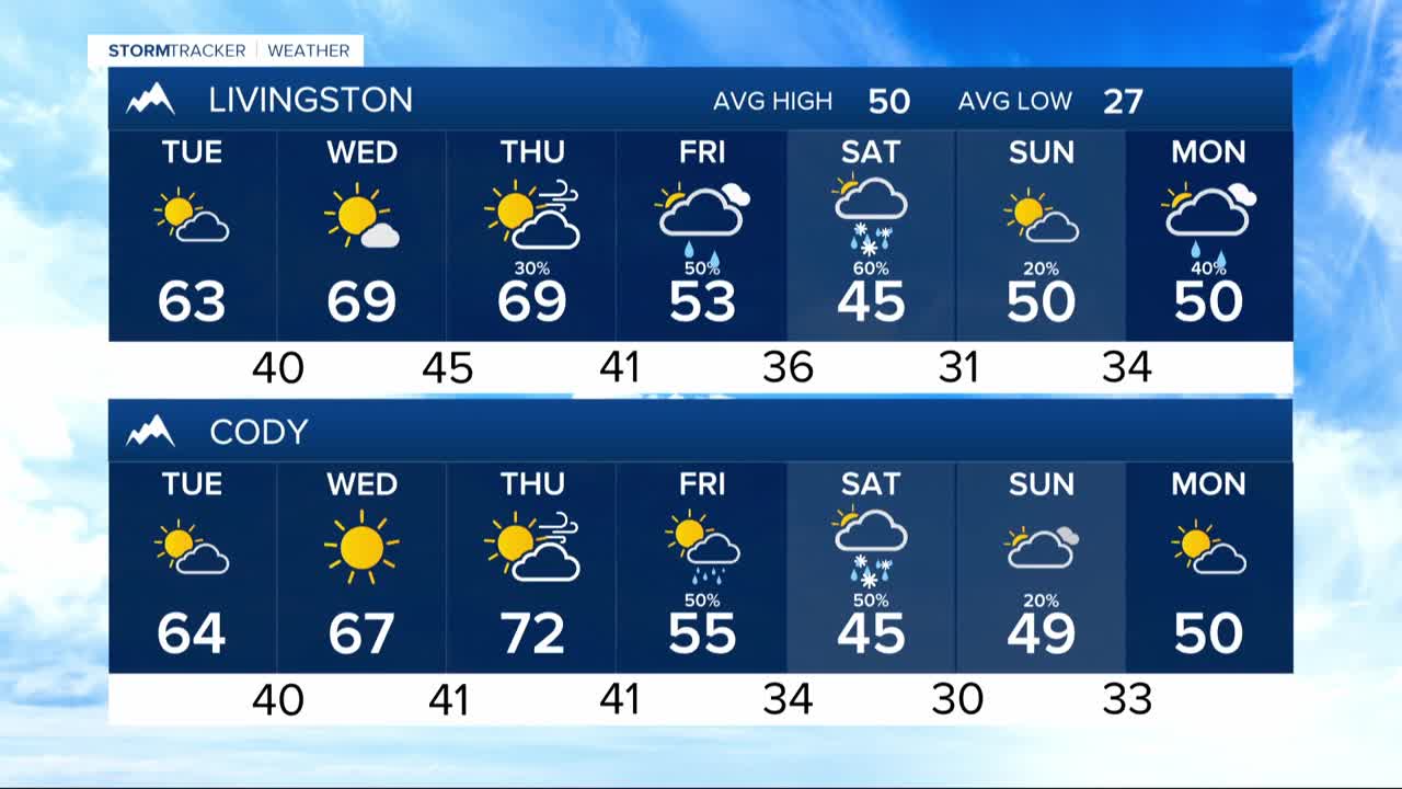
After mild morning temperatures in the mid-30s to mid-40s Tuesday, highs will stay in the 50s to lower 60s with reduced wind speeds.
Midweek, expect to see upper-level ridging dominate, leading to unseasonably warm temperatures. By Thursday, we could potentially be challenging record highs in parts of Southeast Montana in the mid-70s to low 80s.
With highs 20 degrees above average, concerns increase about fire risks. Lighter winds may moderate the fire threat on Wednesday, but Thursday is expected to have stronger winds, particularly in areas west of Billings.
As the week progresses, the ridge will break down by Thursday with the arrival of a cold front. This will lead to cooler temperatures and increased precipitation chances.
The weekend into early next week carries higher uncertainty with potential for a string of successive weather systems and continued cooling, bringing high temperatures back down into the 50s across the region.
