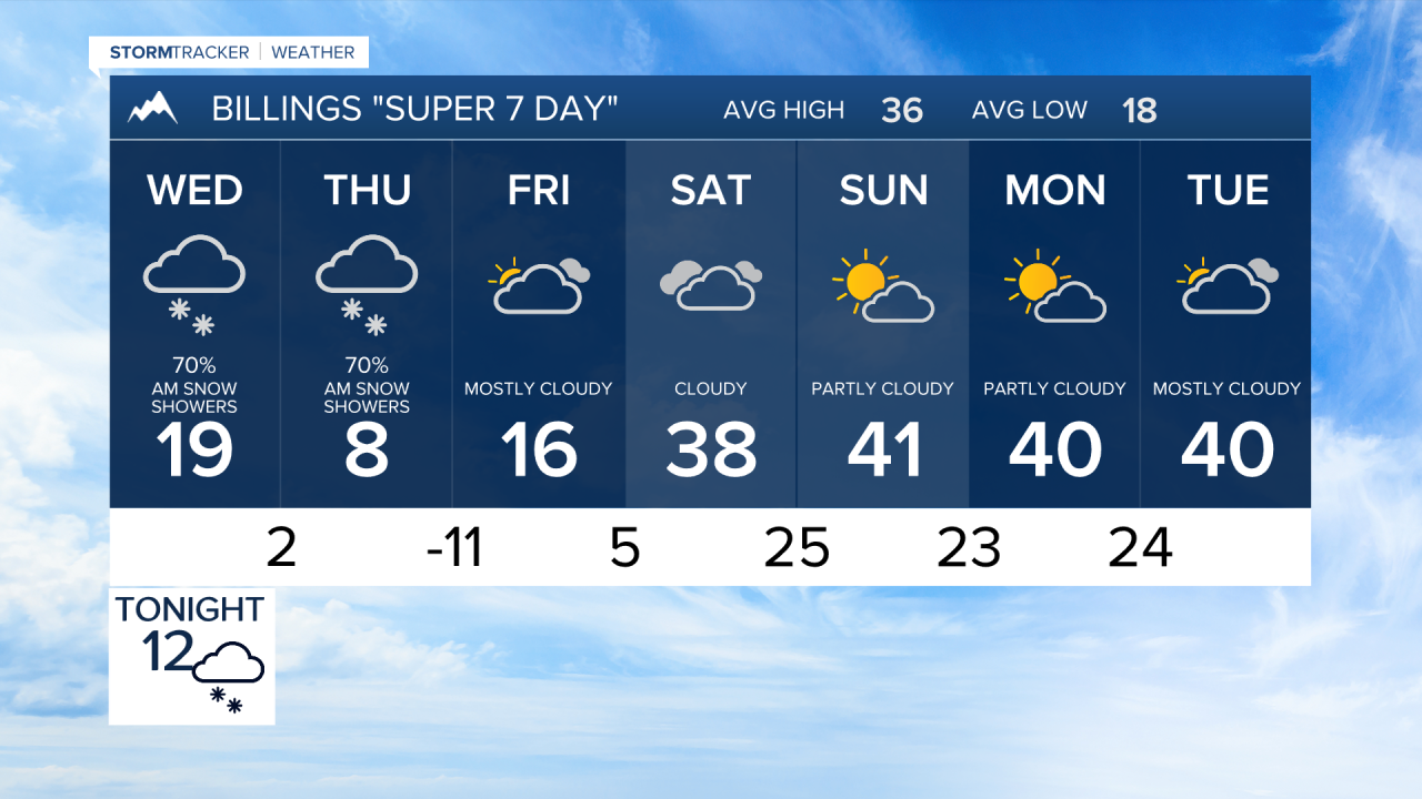
BILLINGS — Winter weather advisories and Winter Storm Warnings blanket most of Montana, where soon snow will blanket the ground. Travel problems are a top concern.
Snow is already flying across portions of the region and will continue through Thursday morning. Accumulations will be heaviest in areas to the north and some areas to the east of Billings, and in the mountain foothills.
Most of the area will see between three and six inches of accumulation but totals up to around 9 inches are possible. Through North Central Montana, accumulations could be considerably higher, with up to a foot and 1/2.
Most of the snowfall will be light and powdery but could cause some visibility problems over a widespread area. Expect impacts to travel.
Wednesday morning temperatures will be mainly into the single digits and teens with afternoon temperatures reaching the teens and 20s. Colder air will start to move into the region and push temperatures down to the single digits above and below 0 Thursday afternoon, with many readings in the teens and single digits below 0 early Friday.
After a chilly day Friday, temperatures quickly rebound to the 30s to 40s in the afternoons on Saturday through at least Tuesday.


