

BILLINGS — WEDNESDAY EVENING THROUGH OVERNIGHT: The western foothills are finishing out Wednesday under relentless wind gusts in the 50–60 mph range. A low-level temperature inversion settles in overnight, pulling winds back into the 30s–40s mph range along the US 191 corridor.
THURSDAY THROUGH FRIDAY MORNING: Thursday kicks off with winds ramping back up as better atmospheric mixing and strengthening upper-level winds combine to bring widespread gusts of 55–70 mph gusts across the western foothills. Thursday night into Friday, gusts of 60–75 mph are likely.
Temperatures regionally on Thursday and Friday will run mid-40s to upper 50s, with the coolest readings in the east. It'll feel deceptively spring-like until the wind reminds you otherwise.
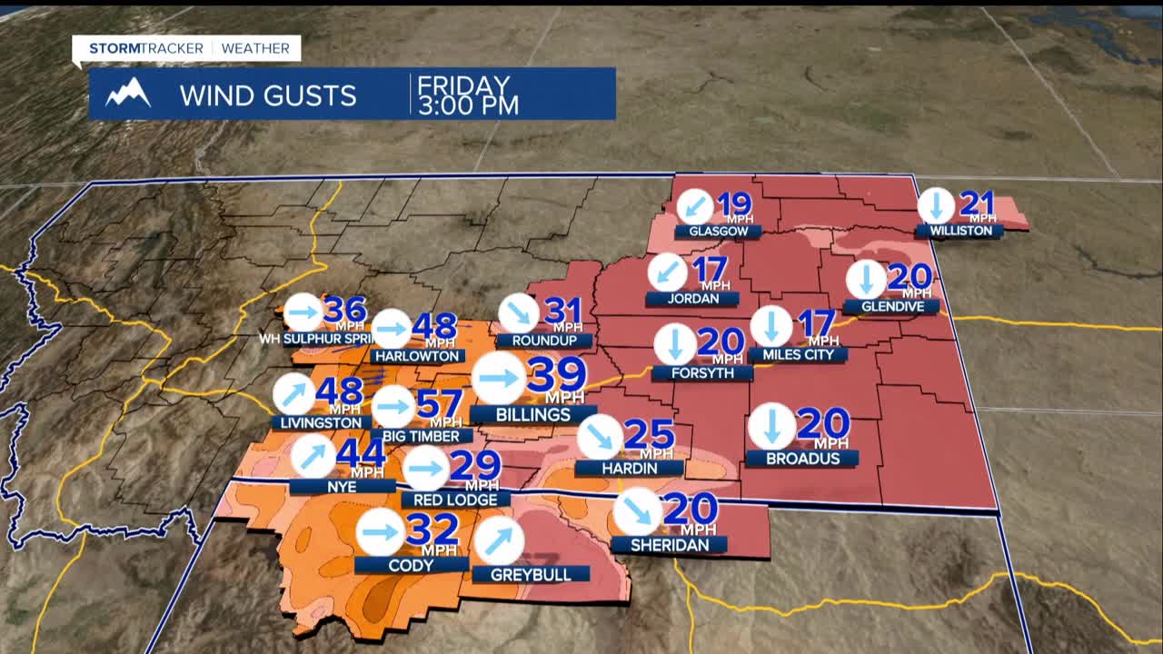
FRIDAY: A clipper system racing across the Canadian Prairies will drag a cold front through the region during the day Friday. The system has lost some of it's zing as it will tend to stay more into the eastern plains towards the Dakotas. But eventually it will help to bring down the winds.
Precipitation chances arrive with the front. The best odds are for areas east and north of Billings to pick up more than an inch of snow. Roads could get slick quickly as temperatures drop.
SATURDAY: The front's passage brings a noticeable but short-lived cool-down, with temperatures dropping into the 30s–40s region-wide Saturday. Snow chances linger, though details are still uncertain. Whatever the case, it doesn't last long.
EARLY NEXT WEEK: Above-normal upper-level heights build back in quickly, sending temperatures rebounding well ahead of seasonal norms by early next week. The wind and cold will feel like a distant memory by Monday.
