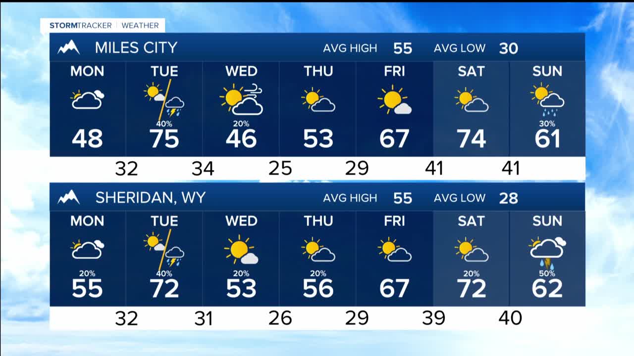


BILLINGS — THROUGH MONDAY: A high pressure ridge over the intermountain west delivers quiet, mostly sunny weather with dry conditions persisting across most of the region. Lows will be in the mid-20a to mid-30s and mostly cloudy.
A wind shift sets up a subtle overnight drama around Sheridan and Livingston, where patchy fog could develop against the mountains. Highs will be mainly in the 50s with 40s in the eastern plains.
TUESDAY: Our next weather system barrels into the region, bringing gusty winds. Livingston, Big Timber, and Harlowton could experience 60 mph winds with at least breezy conditions regionwide.
High temperatures will soar roughly 15° above average in the 60s to mid-70s while relative humidity values plummet toward 20% in the foothills west of Billings. Especially in areas missed by our last round of precipitation, we will face elevated grassfire risks .
Tuesday evening brings a cold front pushing through from northwest to southeast, carrying light precipitation in its wake with just enough energy to spark a few lightning strikes with that evening precipitation and more wind.
WEDNESDAY THROUGH THE WEEKEND: The latter half of the week presents a more uncertain picture. Additional light precipitation is expected but nothing concrete has emerged in the forecast.
Temperature-wise, expect readings to settle near to slightly above average for most of the upcoming week, with Tuesday being the obvious exception thanks to those strong warm winds. There's even potential for another warm surge bringing 70-degree temperatures by week's end, though that's still several days out and subject to the usual forecast uncertainty.
