BILLINGS — Wind in the short term not only causes areas of blowing snow, but aids in a big warm up very quickly. Then another turn around brings back colder and wetter weather.
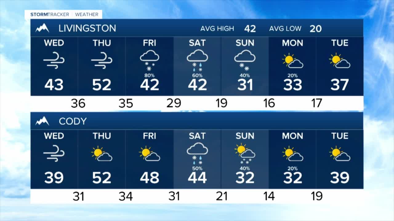
The combination of fresh snow into the mountain foothills and wind gusts topping 60 miles an hour at times closer to the Livingston and Big Timber areas will cause blowing snow threats overnight through Wednesday morning. As temperatures warm into the upper 30s and 40s by the afternoon, the threat of blowing snow will diminish.
Expect continued windy to breezy periods through Thursday, when afternoon readings will hit the 50s and even a few low 60s. Conditions stay dry through Thursday evening.
While the details are very murky at this point, another round of rain and snow will start to move into the area Friday through Sunday. Temperatures will get progressively colder into the early part of next week. And we'll see readings back into the 20s and 30s by Monday.


