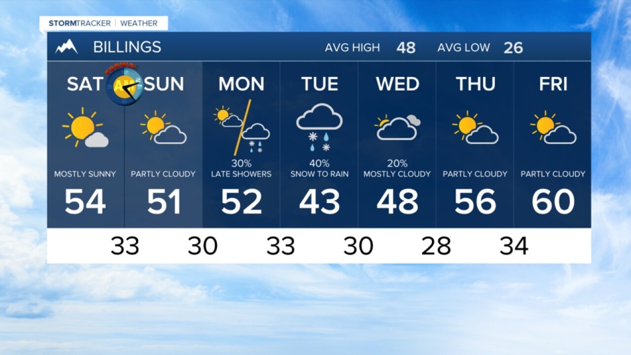

BILLINGS — A ridge of high pressure will bring warmer than average readings through most of southern Montana through Monday. High temperatures will be mainly in the upper 40s to upper 50s with plenty of sun Saturday and increasing clouds by Sunday and Monday.
A major winter storm is developing in southern Wyoming/Colorado. That system could wrap at least some rain or snow into northern Wyoming in extreme Southeast Montana Saturday night through Sunday.
This storm will bring extremely hazardous travel to central and southern Wyoming with some roads and interstates possibly closed. Heavy and blowing snow could accumulate in some areas from 1 to 4 feet.
A disturbance Monday will bring a slight downturn in temperatures and a chance of rain and snow Tuesday. If this system interacts with the weekend system, the precipitation totals may be higher.
Tuesday and Wednesday look to be the coolest days next week with a highs in the 40s and the lows in the 20s. By Friday and Saturday of next week, highs could be hitting the upper 50s to low 60s.
Billings forecast:
Friday night… Clear to mostly clear with a low at about 26.
Saturday and Sunday… Sunny to mostly sunny with a highs in the mid-50s Saturday and 50 – 55 Sunday.
Monday and Tuesday… Highs in the low 50s Monday with increasing clouds. A chance of showers Monday night through Tuesday with a low in the upper 20s to low 30s and the highs Tuesday in the 40s.
